


The Great White Fleet is steaming toward the port of Auckland, New Zealand.
Here is a little information about the current Auckland, New Zealand so much of it applied in 1908.
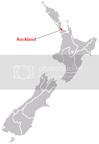
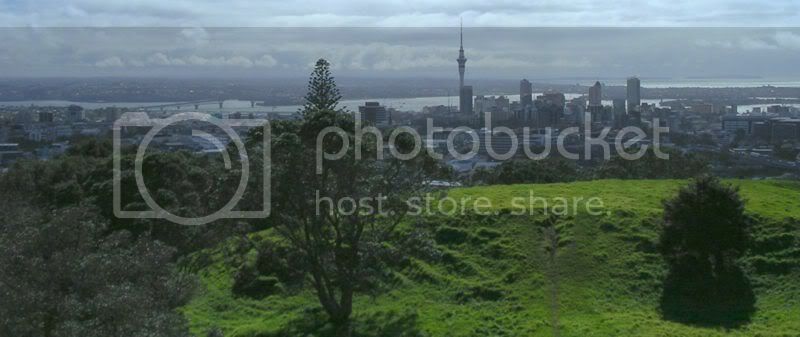
Where is Auckland situated in New Zealand?
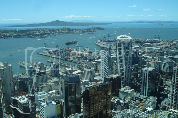
Here is an image of the current city.
The Auckland metropolitan area or Greater Auckland, in the North Island of New Zealand, is the largest urban area of the country. With over 1.3 million people it has over a quarter of the country's population, and demographic trends indicate that it will continue growing faster than the rest of the country.
Auckland also has the largest Polynesian population of any city in the world.
It is a conurbation, made up of Auckland City (excluding the Hauraki Gulf islands), North Shore City, and the urban parts of Waitakere and Manukau cities, along with Papakura District and some nearby urban parts of Rodney and Franklin Districts. In Māori its name is Tāmaki-makau-rau, or the transliterated version of Auckland, Ākarana.
Auckland lies between the Hauraki Gulf of the Pacific Ocean to the east, the low Hunua Ranges to the south-east, the Manukau Harbour to the south-west, and the Waitakere Ranges and smaller ranges to the west and north-west. The central part of the urban area occupies a narrow isthmus between the Manukau Harbour on the Tasman Sea and the Waitemata Harbour on the Pacific Ocean.
It is one of the few cities in the world to have harbours on two separate major bodies of water.
The isthmus was first settled around 1350 and was valued for its rich and fertile land. Many pa (fortified villages) were created, mainly on the volcanic peaks. Māori population in the area is estimated to have peaked at 20,000 before the arrival of Europeans. This event - and the guns which they traded to local iwi - upset the local power balances. This resulted in extensive inter-tribal warfare, which together with some introduced plagues resulted in the area having relatively low numbers of Māori when European settlement in New Zealand started in earnest (there is however no indication that this was the result of a deliberate European policy).
After the signing of the Treaty of Waitangi in February 1840 the new Governor of New Zealand, William Hobson chose the area as his new capital. However, even in 1840, Port Nicholson (later Wellington), was seen as a better choice for an administrative capital, due to its proximity to the South Island, which was being settled much more rapidly. At the same time, Auckland was the capital and principal city of the Auckland Province, until the provincial system was abolished in 1876. Nonetheless, even after losing its status as national capital in 1865, immigration to the new city stayed strong.
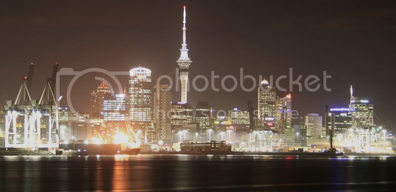
Auckland City at night
Becoming a base against the Māori King Movement in the early 1860s, and continued road building towards the south into the Waikato, enabled Pākehā (European New Zealanders) influence to spread out from Auckland. It also grew fairly rapidly, from 1,500 in 1841 to 12,423 by 1864. The growth occurred similarly to other mercantile-dominated cities, mainly around the port, and with many of the problems of overcrowding and pollution common to it.
Trams and railway lines shaped Auckland's rapid extension in the early first half of the 20th century, but soon after the dominance of the motor vehicle emerged and has not abated since, with arterial roads and motorways becoming a defining (and geographically dividing) feature of the urban landscape. They also allowed further massive expansion, resulting in the growth of associated urban areas like the North Shore (especially after the construction of the Auckland Harbour Bridge, and Manukau City in the south.
A large percentage of Auckland is still dominated by a very suburban style of building, giving the city a very low population density: although it has not much more than a seventh of the population of London, it sprawls over a considerably larger area, which makes public transport costlier than in high-density cities elsewhere.
Auckland straddles the volcanoes of the Auckland Volcanic Field. The approximately 50 volcanic vents in the field take the form of cones, lakes, lagoons, islands and depressions, and several have produced extensive lava flows. Most of the cones have been partly or completely quarried away. The individual volcanoes are all considered extinct, although the volcanic field itself is merely dormant.
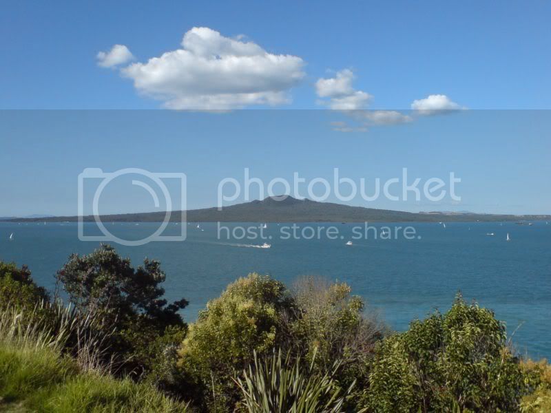
The most recent and by far the largest volcano, Rangitoto Island, was formed within the last 1000 years, and its eruptions destroyed the Māori settlements on neighbouring Motutapu Island some 700 years ago. Rangitoto's size, its symmetry, its position guarding the entrance to Waitemata Harbour and its visibility from many parts of the Auckland region make it Auckland's most iconic natural feature. It is eerily quiet as almost no birds and insects have settled on the island because of the rich acidic soil and type of flora that has adapted to grow out of the black broken rocky soil.
The harbour with Rangitoto Island
Auckland lies on and around an isthmus, less than 2 kilometres wide at its narrowest point, between Mangere Inlet and the Tamaki River. There are two harbours in the Auckland urban area surrounding this isthmus, Waitemata Harbour to the north, which opens east to the Hauraki Gulf, and Manukau Harbour to the south, which opens west to the Tasman Sea.
Bridges span parts of both these harbours, notably the Auckland Harbour Bridge crossing the Waitemata Harbour west of the Auckland CBD. The upper reaches of the Manukau and Waitemata Harbours are spanned by Mangere Bridge and the Upper Harbour Bridge respectively. In earlier times, portage paths crossed the narrowest sections of the isthmus.
Several islands of the Hauraki Gulf are administered as part of Auckland City, though they are not officially part of the Auckland metropolitan area. Parts of Waiheke Island effectively function as Auckland suburbs, while various smaller islands near Auckland are mostly recreational open space or nature sanctuaries.
This is an image of Auckland City from Mt. Eden
Regards
Sean